New Water Footprint Assessment Tool is Online
 by Matt Luna, IES Information Officer
The Hague, 18 March 2020
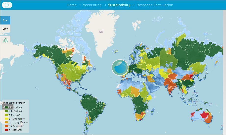
The new Water Footprint Assessment Tool is now online.
According to the Water Footprint Network media release, “Users can perform more comprehensive evaluations with the redesigned online tool from the Water Footprint Network. This free interactive tool enables development of exact insights and solutions for efficient water management, through use of the latest global scientific data on water related to commodities, crops, geographic areas and water sources”.
World Water Day 2020 (22 March) highlights the linkage of water and climate change, and is a key time to relaunch this tool. “A warming climate adds urgency to monitoring water use, as we’ll see larger water footprints across sectors. And as water use increases, our supply remains roughly the same, so use of smart approaches with our Assessment Tool facilitates more fair, sustainable and profitable practices for everyone,” said Dr. Rick Hogeboom, Executive Director of the Water Footprint Network.
Read more about the new Water Footprint Assessment Tool
Go directly to the Water Footprint Assessment Tool data base
Here are some other useful on-line tools related to environment and security:
World Resources Institute
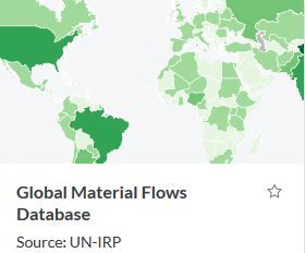 The World Resources Institute (WRI) produces maps, charts, data sets, infographics, and other visual resources as part of their commitment to turn “information into action.”
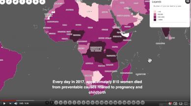
These include Resource Watch is a free, open data visualization platform that serves as a repository for the world's best available data. It provides journalists, analysts, decision makers, and students the opportunity to explore more than 200 available data sets on topics ranging from climate change to human migration, deforestation to air quality, agriculture to energy and much more.
MapX
 UNEP/GRID-Geneva and UN Environment have developed MapX, an online platform for managing geospatial data on natural resources. Field applications of MapX so far include chemicals management, disaster risk reduction, biodiversity planning, land use planning, extractive industry, renewable energy and environmental security. MapX targets a wide community of users that are primarily UN Environment and partners, the Secretariats of Multilateral Environmental Agreements (MEAs) and other UN agencies mandated to collect and use geospatial data in environmental decision making. Civil society groups, non-governmental organizations, academia and citizens complement this set of users. MapX was designed in 2014 and since then continuously improved with wide international stakeholder consultations.
the partners in the project state that "We aim to eliminate the fragmentation of spatial information and provide a trusted platform for data sharing, analysis and visualization". MapX provides the following core services:
- Catalog of best available spatial data
- Real time analytical and visualization tools
- Dynamic communication products and services
National Ecological Observatory Network (NEON)
 The National Science Foundation’s National Ecological Observatory Network (NEON) is a $500 million program to measure environmental change on a continent-wide scale in the United States that has just become operational. It presents open data to understand how our aquatic and terrestrial ecosystems are changing.
NEON's aquatic and terrestrial sites are strategically located across the U.S. within 20 ecoclimatic domains that represent regions of distinct landforms, vegetation, climate and ecosystem dynamics.
Compound Fragility-Climate Risks Heighten Vulnerability to Humanitarian Emergencies and Instability
 A study by Strauss Center scholars provides robust new data on where—and how—fragility and climate risks combine to make populations more vulnerable to humanitarian emergencies and instability across the globe.
The study report, The Intersection of Global Fragility and Climate Risks, identifies the locations where fragility and climate risks co-occur in significant ways around the world. It reveals that most highly fragile states—where institutions and mechanisms for meeting public needs are already strained—have a large number of people or large share of the population facing high climate risks, adding challenges that can exceed state capacity and societal resilience.